
Google Transit Partners
Encouraging public transport by making transit information accessible

Google Maps Transit Partners is a program that allows transport authorities and operators to share their data with Google Maps, making it easier for users to plan their public transport journeys.

How Google Transit Partners helps cities
Google Maps Transit Partners helps solve this by providing a platform for transit agencies to integrate their data directly into Google Maps. This makes transit information accessible to over 2 billion Google Maps users, helping them to easily find and use public transportation.
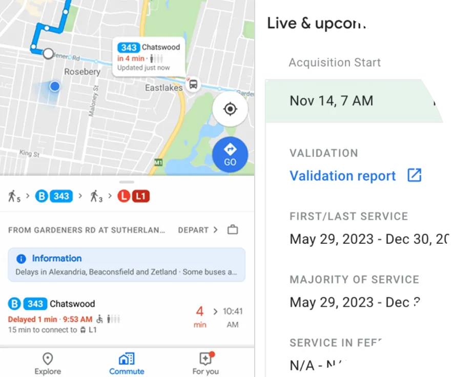
Partners can share both static and real-time data, including:
- Static schedules
- Real-time data including departure and arrival times, service alerts, and vehicle positions
- Accessibility information, such as wheelchair accessibility
- The data is shared using the GTFS and GTFS-realtime formats
Key benefits

Real-time updates
Provide passengers with accurate, live transit information.
Accessible planning
Passengers can plan trips in their native language, with Google’s multi-language options.
Mode shift
Prompt riders when there are options for more sustainable transportation choices using transit.

Real-time updates
Provide passengers with accurate, live transit information.
Accessible Planning
Passengers can plan trips in their native language, with Google’s multi-language options.
Mode shift
Prompt riders when there are options for more sustainable transportation choices using transit.
Impact on users and cities
By making public transportation more accessible and easier to use, Google Maps Transit Partners helps cities to encourage transit usage, reduce emissions and traffic congestion, and ensure equitable access to transportation for all citizens. The target user groups are public authorities, local government bodies and government agencies involved in urban development, infrastructure, and public services, as well as trusted private partners that manage public infrastructures such as transportation networks.

Learn more about Google Transit Partners
See the product in action and explore how it works in the real world

