Jump to Content

Google Earth

Helping cities make informed decisions using rich geospatial data and imagery
google-earth-hero-2x.webp
Google Earth is a platform for action that provides no-code geospatial evaluation and analysis tools, enabling faster, more holistic decision-making and seamless collaboration.
the-challenge-2x.webp

The challenge

For twenty years, Google Earth has provided a new way to see and understand our world. Today, urban planners and city officials are faced with the challenge of analyzing vast amounts of geospatial data to make informed decisions about climate resilience, urban planning, and more. This process can be time-consuming and complex. Google Earth has evolved from an exploration tool to a platform for action, helping professionals find, prepare, and analyze geospatial data to drive real-world impact at scale.

How Google Earth helps cities

Google Earth helps cities and urban planners by providing a comprehensive, interactive model of our world to analyze, build, and collaborate.
The platform's capabilities are designed to streamline workflows:
How Earth helps_Explore.webp

Explore

Discover rich geospatial data and imagery. Google Earth combines aerial photography, satellite imagery, 3D topography, geographic data, and Street View into a real-world canvas.
how-earth-helps-analyze-2x.webp

Analyze

Generate geospatial insights faster with AI. Accelerate workflows with Google's unique data layers and AI-powered insights. With Gemini capabilities, you can reduce the time spent finding, preparing, and analyzing geospatial data from days to minutes on a no-code platform.
how-earth-helps-design-create-2x.webp

Design & create

Create custom maps with built-in no-code tools and import your own data with ease. You can also evaluate building and solar design options in minutes.
how-earth-helps-visualise-2x.webp

Visualize & collaborate

Work together and tell compelling stories. Effortlessly collaborate with your team and create engaging presentations with immersive maps.

Key benefits

Google Earth provides powerful AI and no-code tools for rich geospatial insights and analysis
key-benefits-2x-2.webp
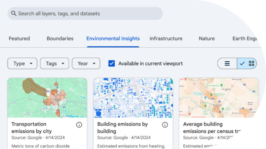
Unlock powerful geospatial insights with no-code
Leverage rich, high-resolution geospatial data combined with intuitive, no-code tools and AI for smarter decision-making.
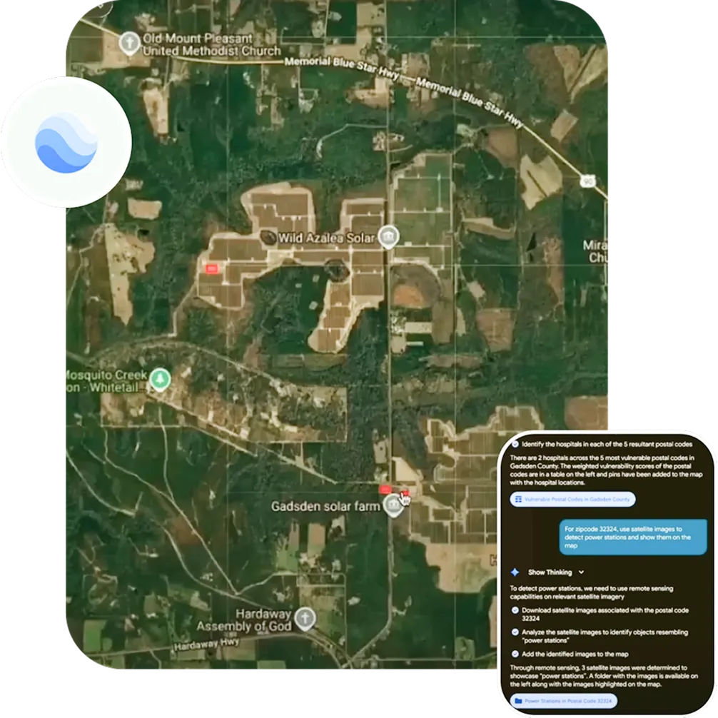
Accelerate analysis with Gemini capabilities
Cut data preparation and analysis time from days to minutes on a no-code platform.
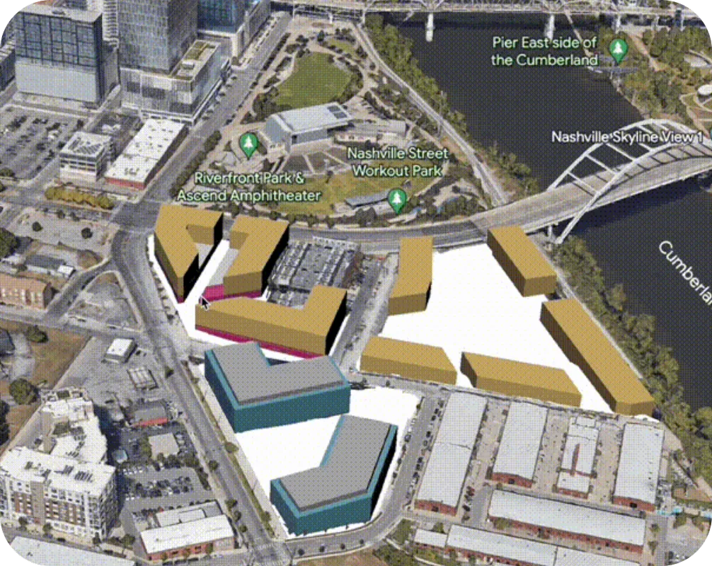
Build maps with powerful data layers
Use built-in no-code tools to layer datasets, integrate your own information, and create interactive, data-driven maps.
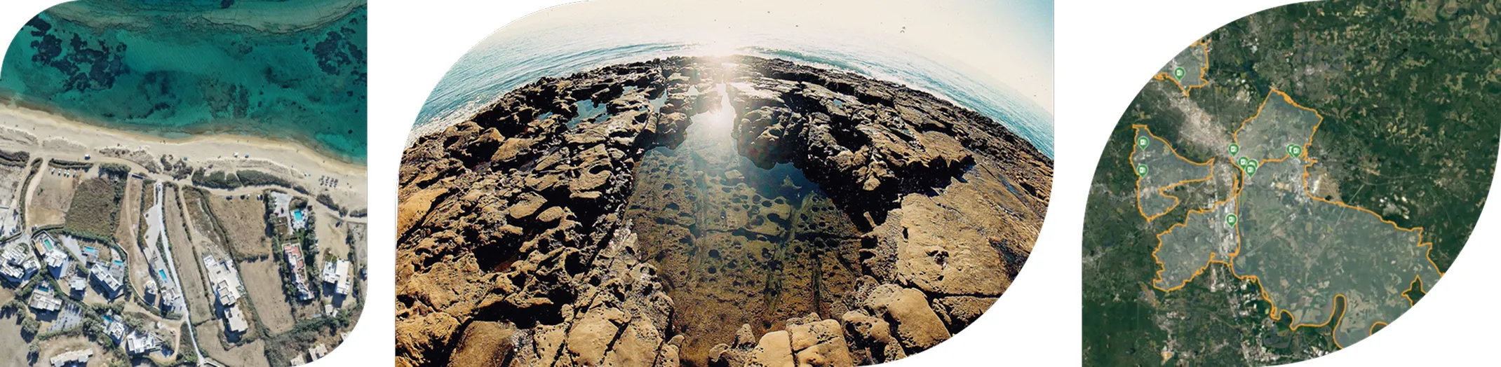
Visualize your city like never before
Access historical imagery, high-fidelity satellite imagery, and customizable basemaps to uncover patterns and trends over time.
key-benefits-2x-2.webp

Impact on users and cities

Google Earth is a proven platform for data-driven urban decisions, trusted by urban planners worldwide. The solutions offered by this platform impacts various city challenges, including
  • Heat resilience

    Identify urban heat islands and target hotspots for tree planting interventions. Pinpoint hotspots, assess community needs, and target interventions for cooling strategies like trees and reflective roofs.

  • Sustainable building

    Accelerate planning with AI-powered tools to evaluate building designs and solar potential for urban development. Plan greener projects, faster, by identifying ideal building locations, accelerating solar analysis, and analyzing environmental impact.
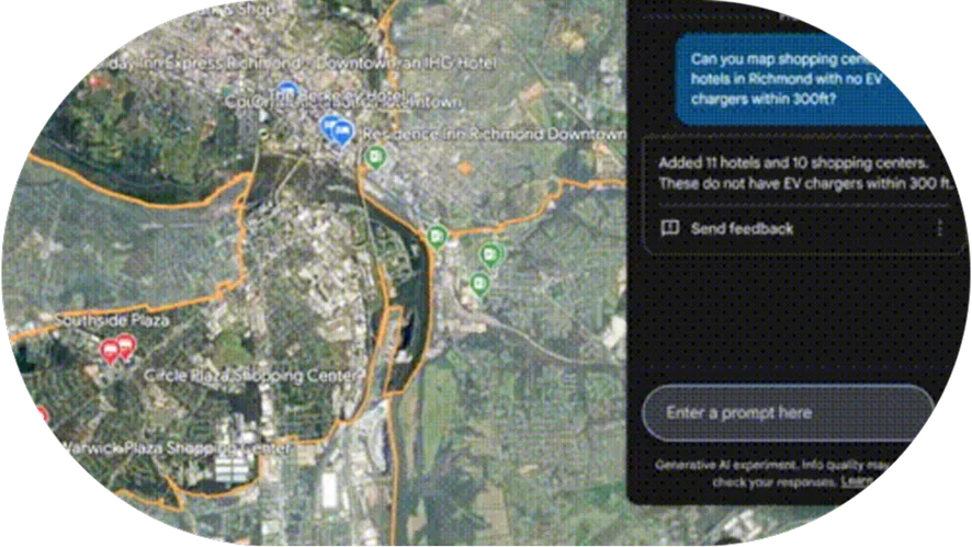
  • EV infrastructure

    Layer EV Google Search Interest data with existing charging station locations to identify opportunities for new charger installations. Layer EV demand and infrastructure data into actionable insights to spot ideal locations and plan strategically.
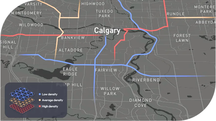
  • Mobility planning

    Visualize traffic patterns with data on vehicle trips and congestion points to improve mobility and safety. Understand traffic movement patterns, pinpoint problem intersections, and target solutions to help reduce traffic congestion.

Learn more about Google Earth

See the product in action and explore how it works in the real world